
Urban planning and airspace integration for advanced air mobility
Vertiport applications are arriving at planning departments that have no code to evaluate them against. The zoning ordinance stops at the roofline. The comprehensive plan doesn't contemplate a corridor. The obstacle data is a 2D layer with no heights on it.
We build the planning instruments that let a city or a state say yes — or say no — on defensible grounds.
The gap
No low-altitude planning code.
Zoning regulates what happens on a parcel. Nothing regulates what happens two hundred feet above it — which categories of aircraft, at what hours, over which land uses, at what noise level.
No obstacle data that works in three dimensions.
Most municipal GIS has building footprints without heights, and nothing at all on cranes, transmission lines, antennas or tree canopy. You cannot evaluate a flight path against a 2D map.
No defensible siting method.
Sites get proposed by whoever owns the land. Without repeatable criteria, every approval is an argument and every denial is a lawsuit.
Vertical zoning
Low-altitude airspace is a land-use question before it is an aviation question. The band where advanced air mobility operates sits above the reach of existing municipal code and below the floor of controlled airspace. That band is currently governed by nothing.
What we deliver
Low-altitude airspace planning code
A drafted code section covering aircraft categories, permitted land uses by zone, operating hours, noise thresholds, buffer requirements and the approval pathway. Delivered as ordinance-ready language plus a staff review checklist.
How the siting analysis works
Siting decisions get challenged. The model has to be explainable to a commission and reproducible by someone who wasn't in the room.
We build criteria layers on a common scale, weight them using pairwise comparison with a published consistency check, and apply hard exclusions separately from scored criteria — a critical-infrastructure buffer is a disqualification, not a low score. The output is a suitability surface, a ranked candidate list, and a record of exactly which criterion drove each result.
The site suitability analysis toolbox, step by step in ArcGIS Pro: study area definition, building and parcel sensitivity analysis, vertiport safety buffers, and risk classification.
Applied to real geography
The same method, run across three metropolitan areas. Each surface combines population density, land cover, transport access and infrastructure proximity, with hard exclusions applied separately.
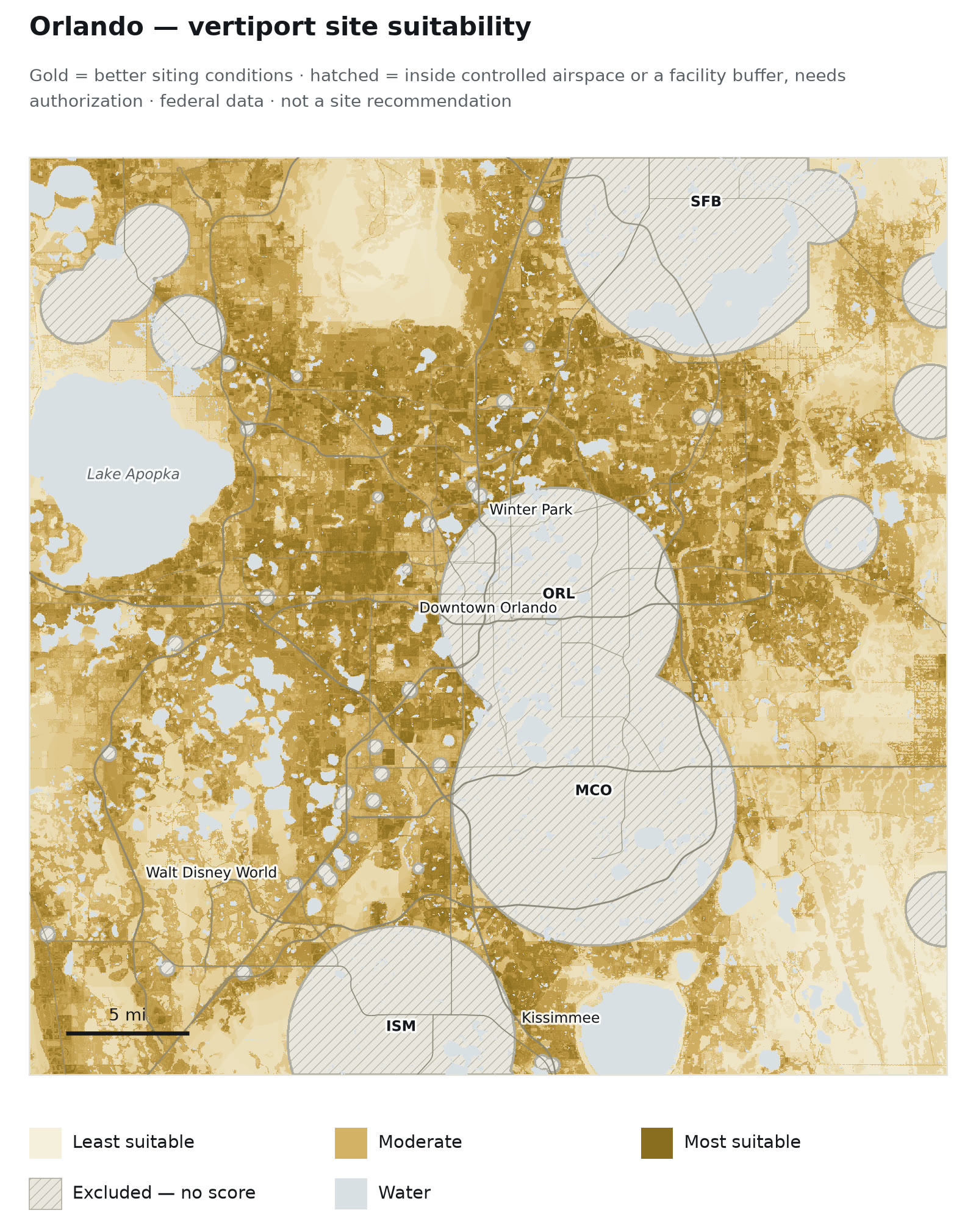
Methodology illustrations built from public federal datasets. Not site recommendations.
Vertiport geometry
Siting output has to resolve to real geometry. Touchdown and liftoff area, final approach and takeoff area, safety area, and the approach and departure surfaces that determine which obstacles matter.
Engagement shape
A full programme runs about twelve months, with the four workstreams overlapping. The planning code and the obstacle database start together, because the code defines what the database has to contain. Siting tooling depends on both. Economic analysis runs throughout and closes last, because it needs the site outputs.
Individual workstreams can be scoped separately.
Prior work
LuftCar has delivered advanced air mobility planning work at municipal scale.
Read the announcementIf you're being asked to evaluate a vertiport application and you don't have a code to evaluate it against, that's the conversation to have.