Site-suitability renders, in depth
Every layer of the siting method, rendered from public data: the national datasets it draws on, the metro screening surfaces, the criteria beneath them, and a district-scale assessment in each metropolitan area.
Methodology illustrations built from public federal datasets. Not site recommendations. District assessments are illustrative analyses, not proposals.
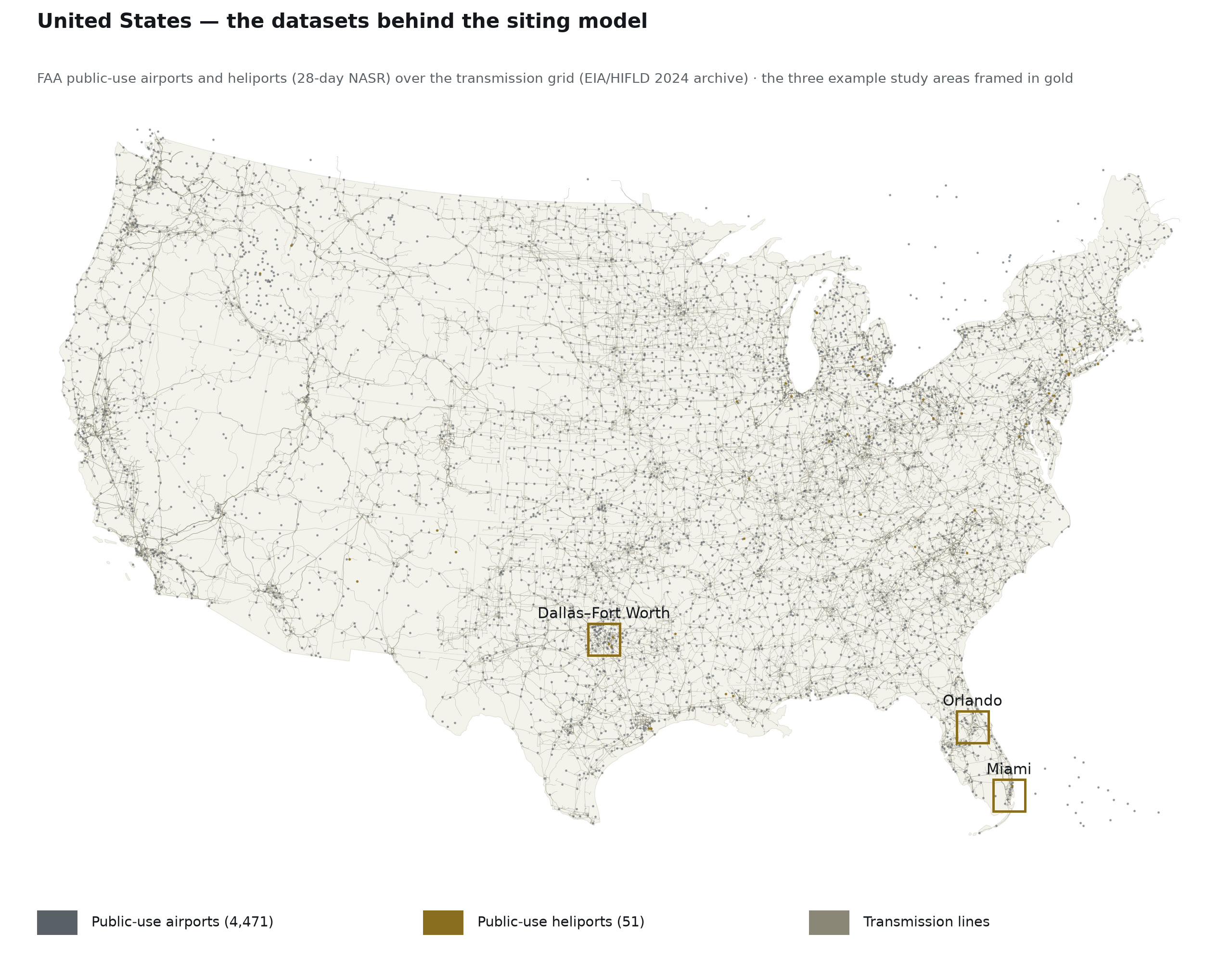
The national picture
Public-use aviation facilities and the transmission grid — the datasets the siting model draws on, held nationally.
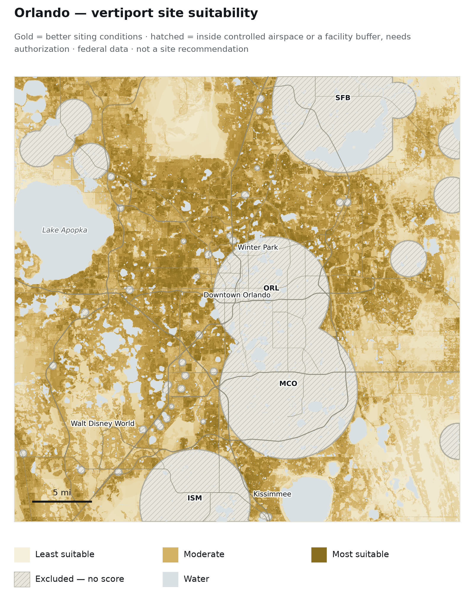
Metro screening
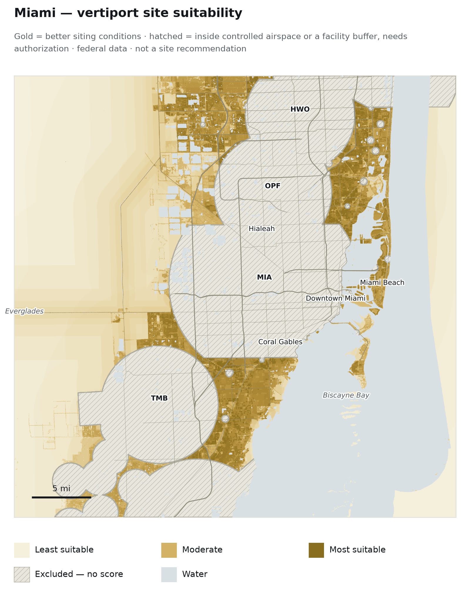
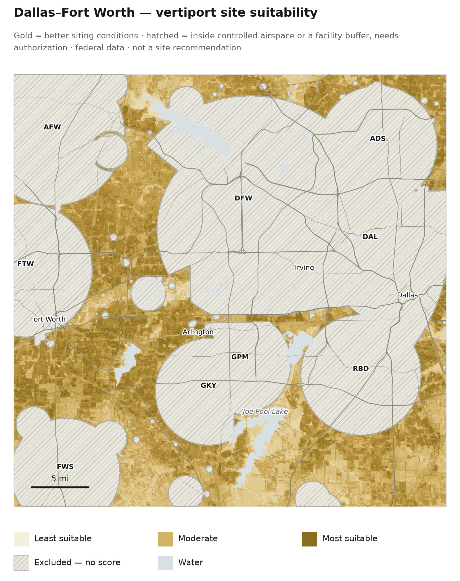
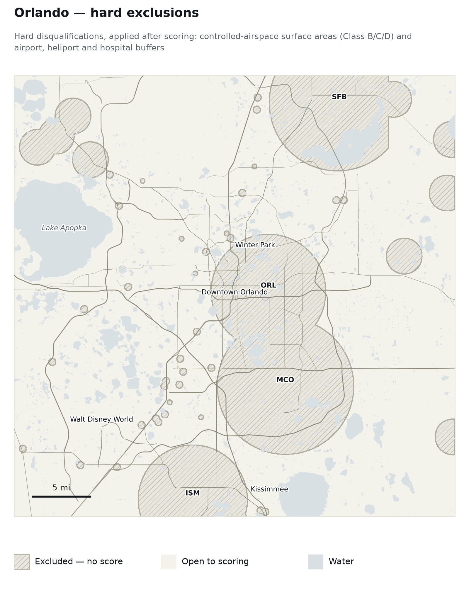
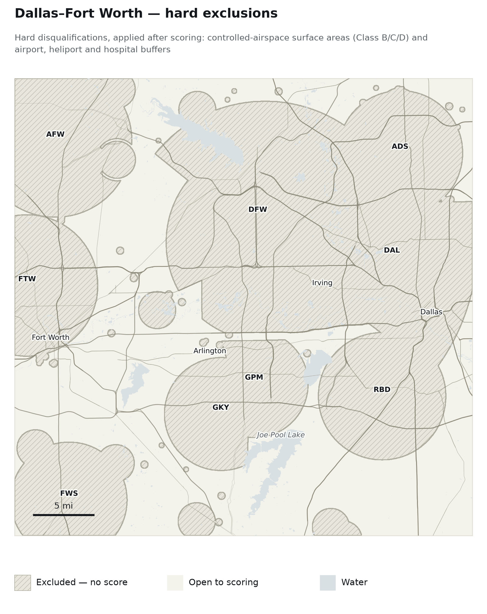
The weighted-overlay suitability surface for each metropolitan area, with controlled-airspace and facility exclusions hatched.
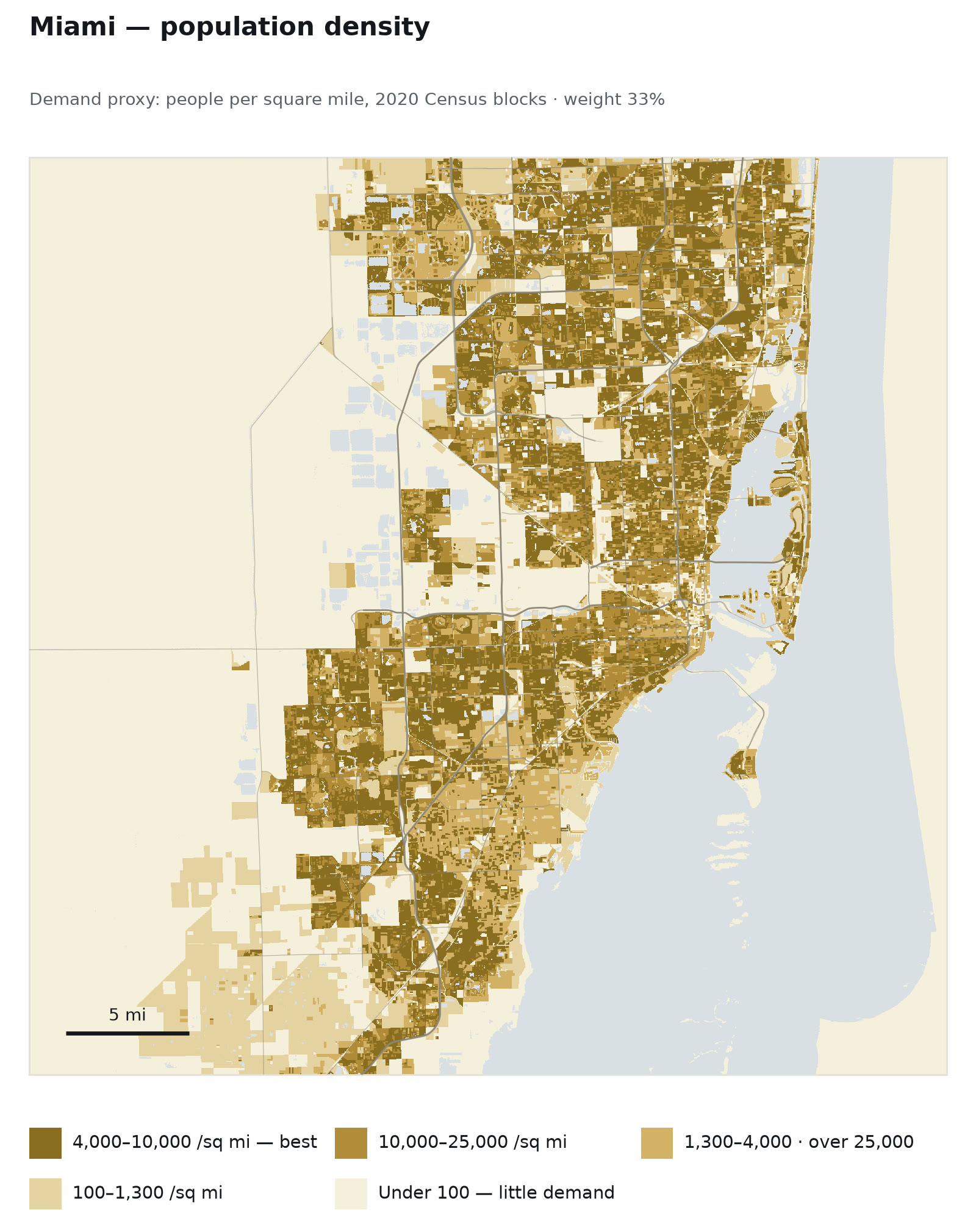
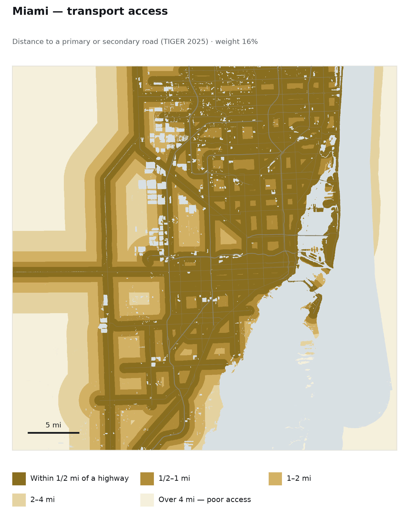
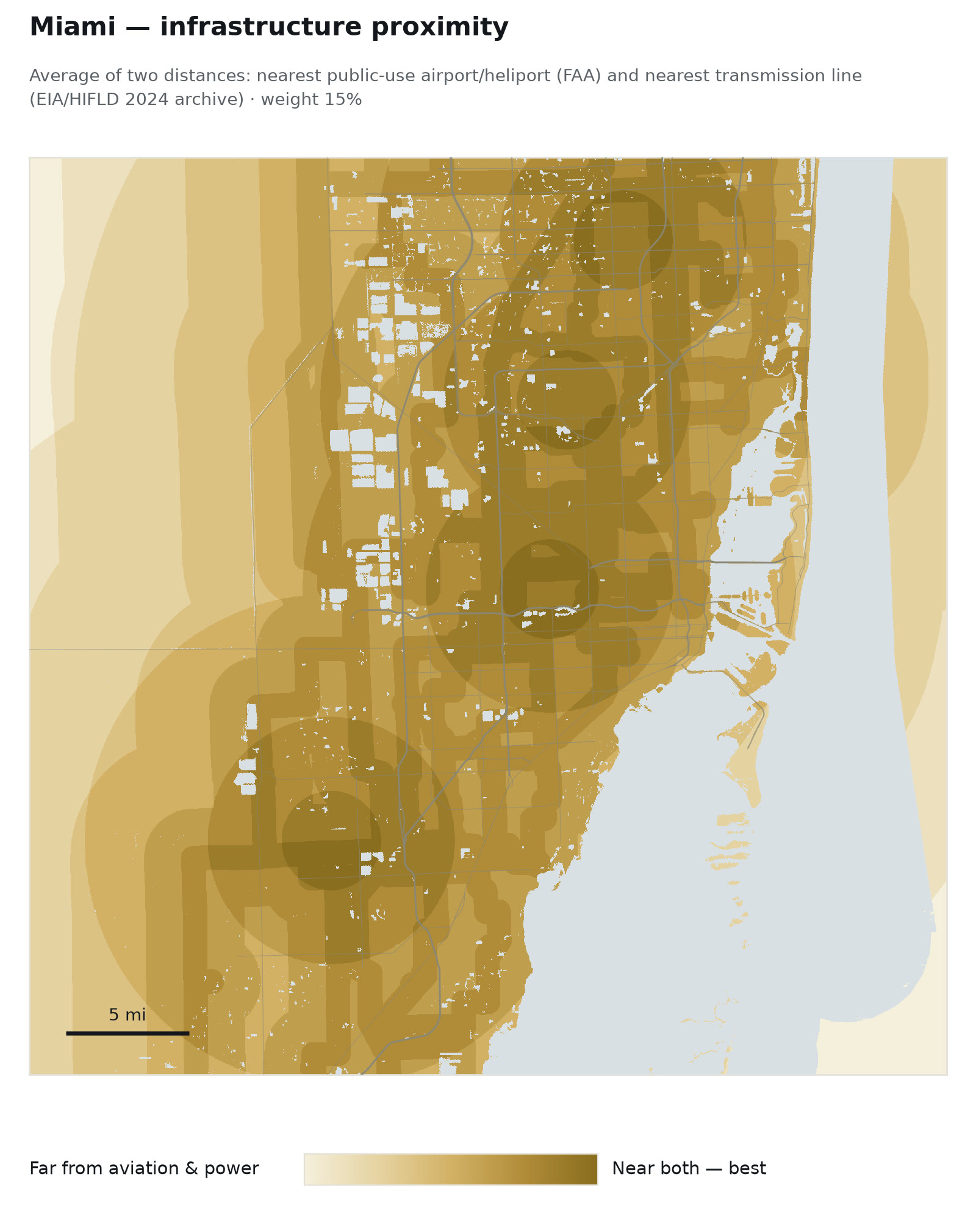
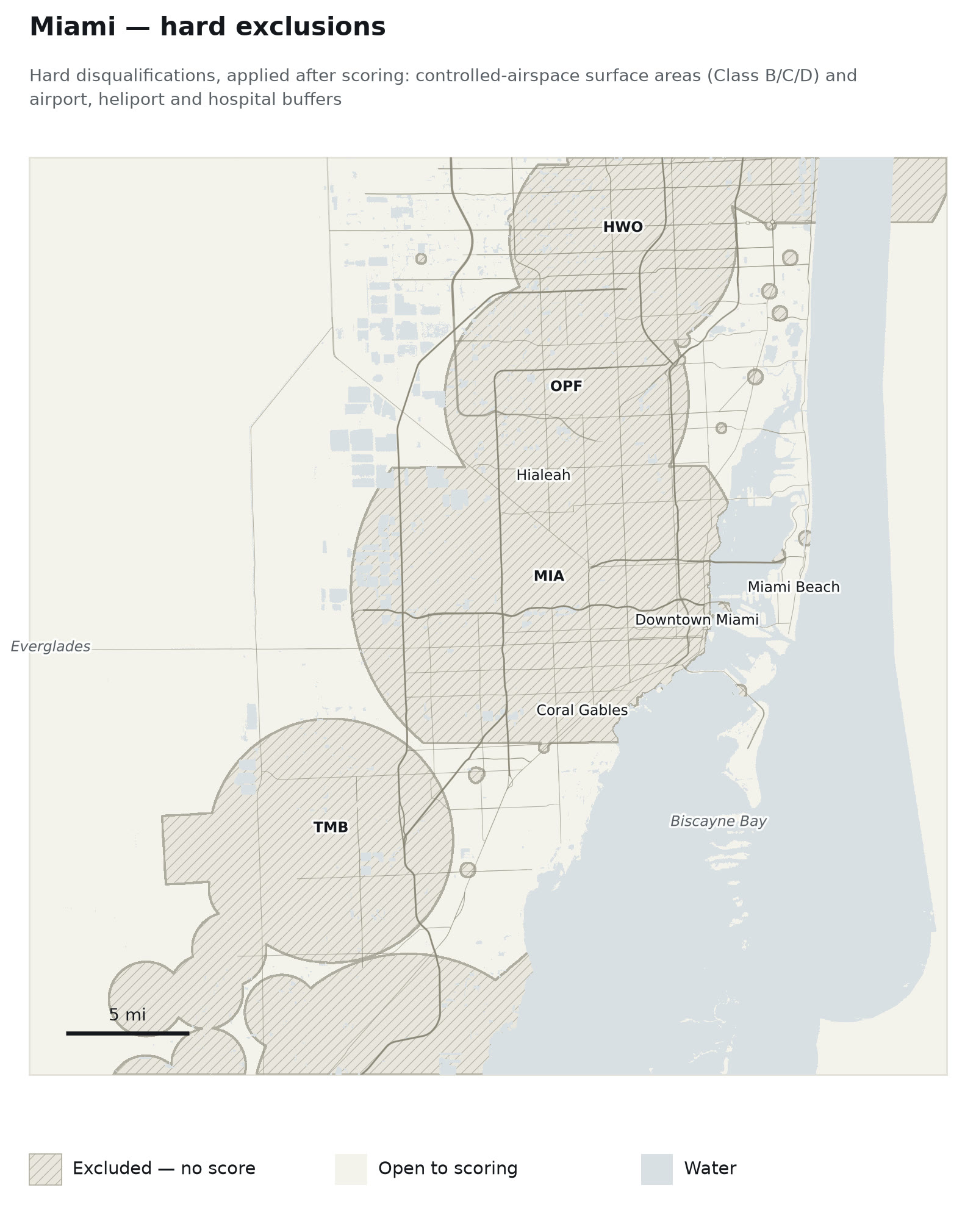
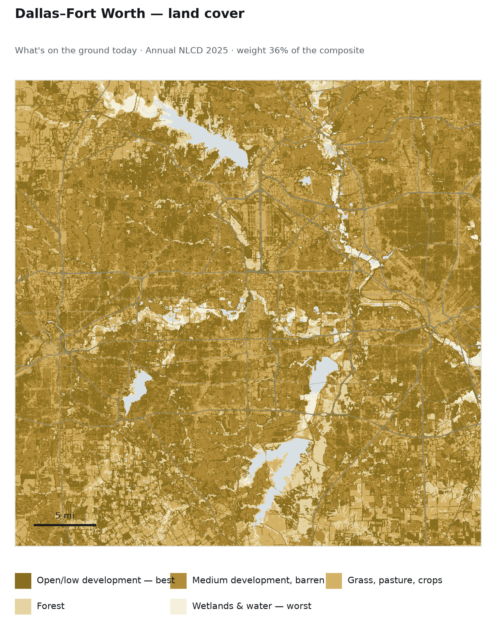
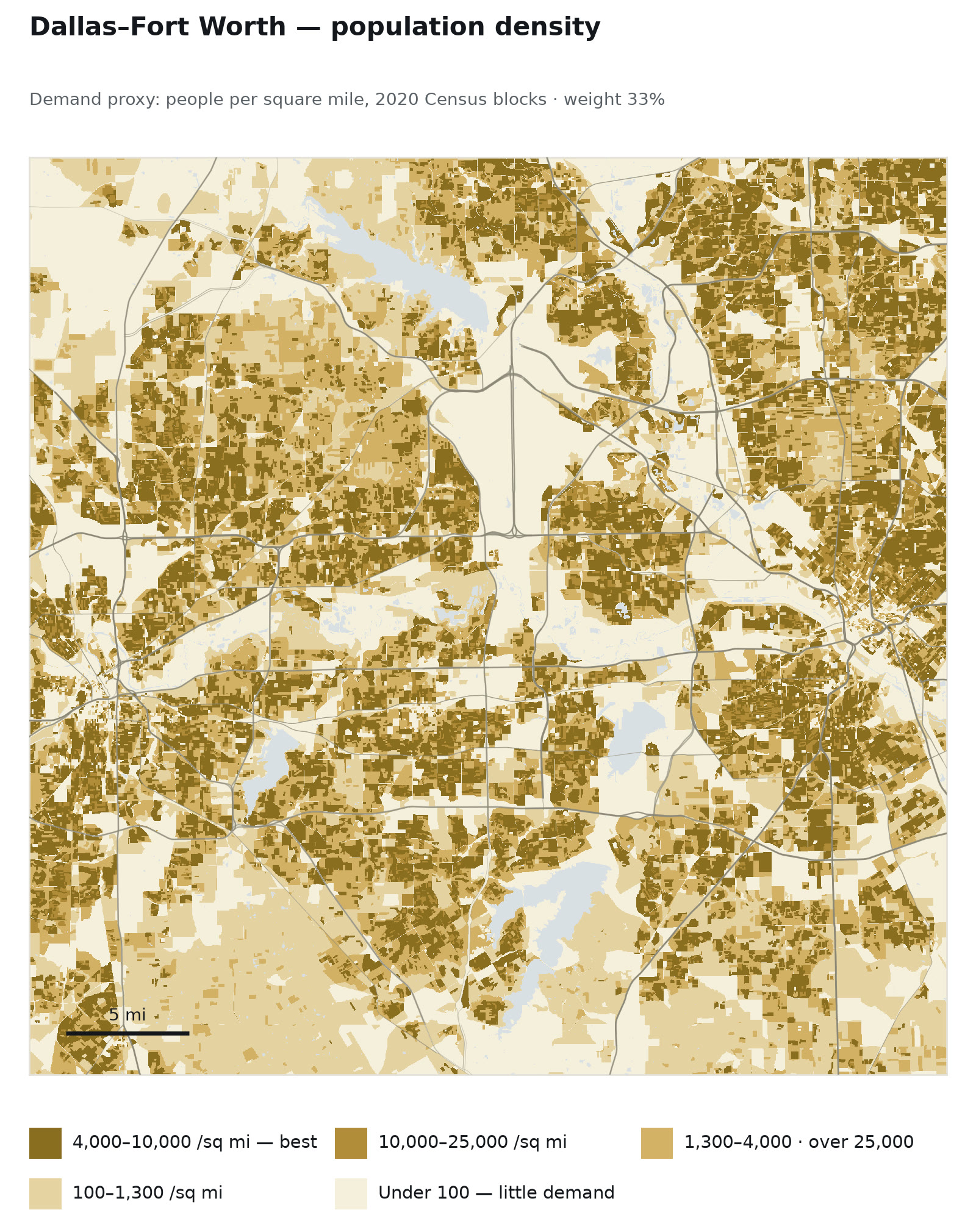
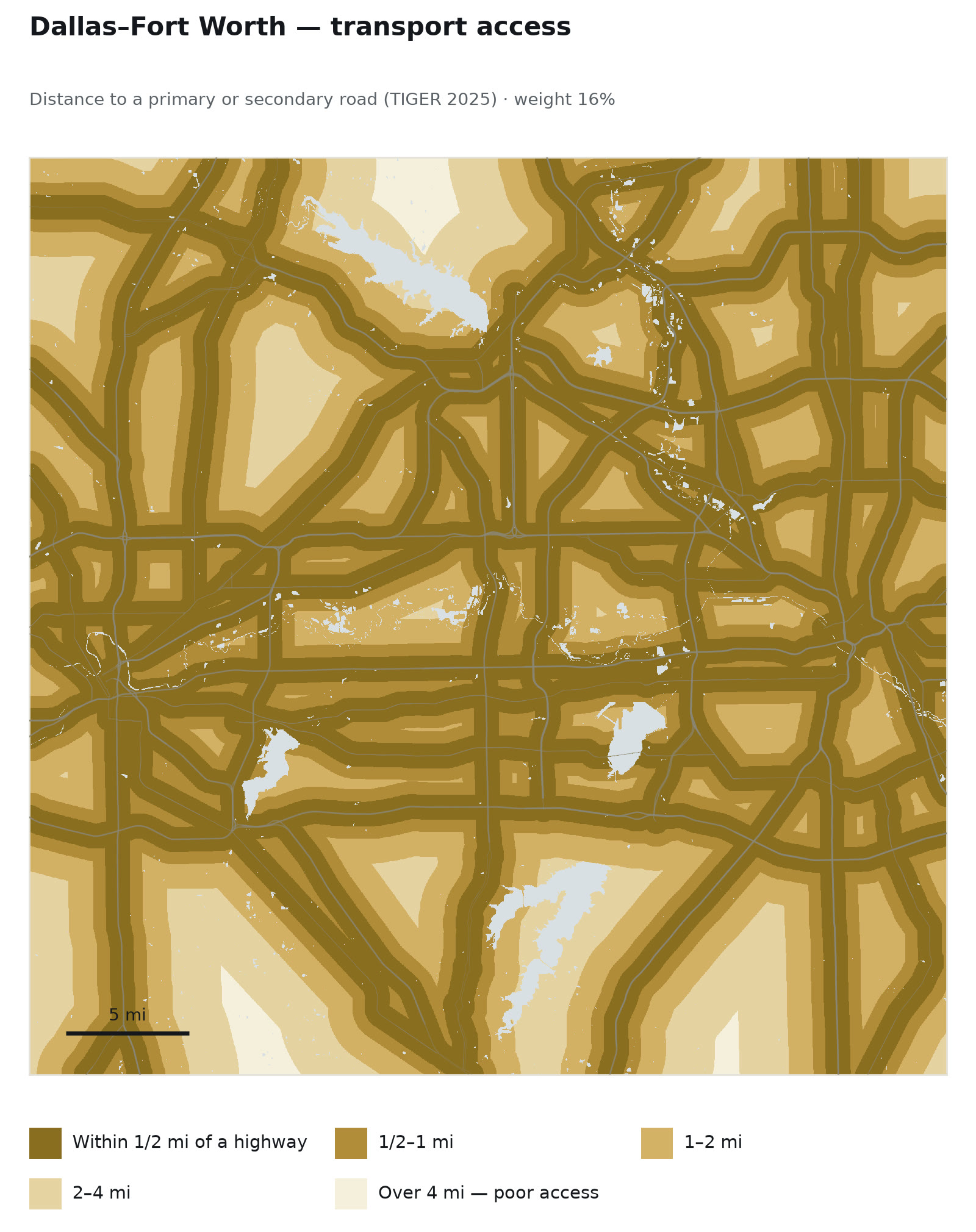
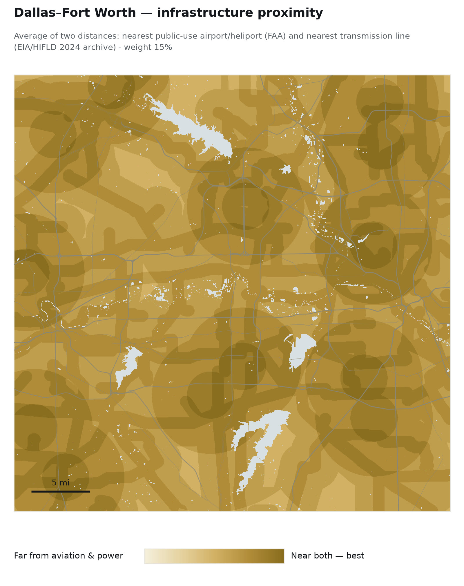
The criteria beneath the surface
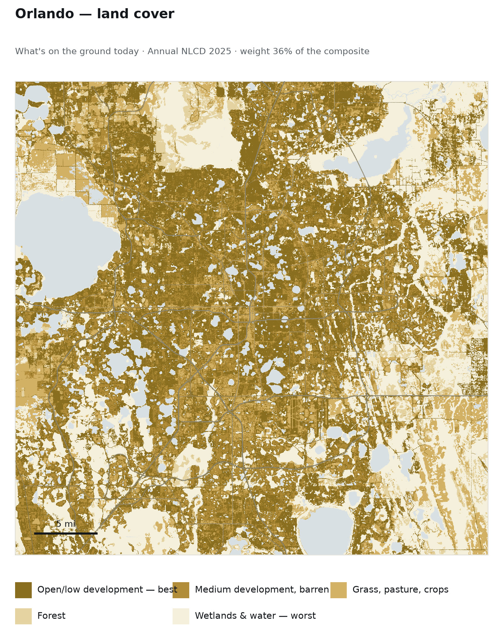
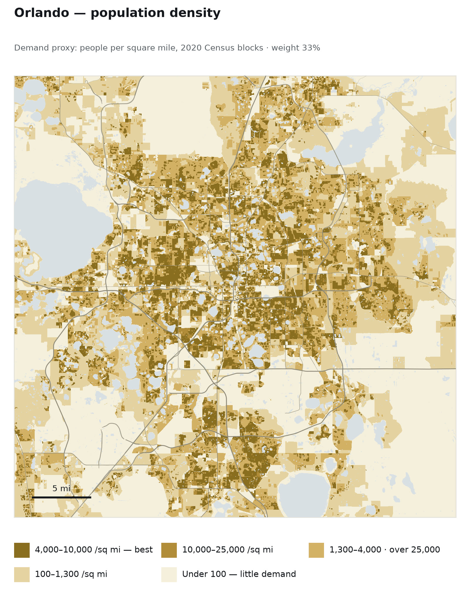
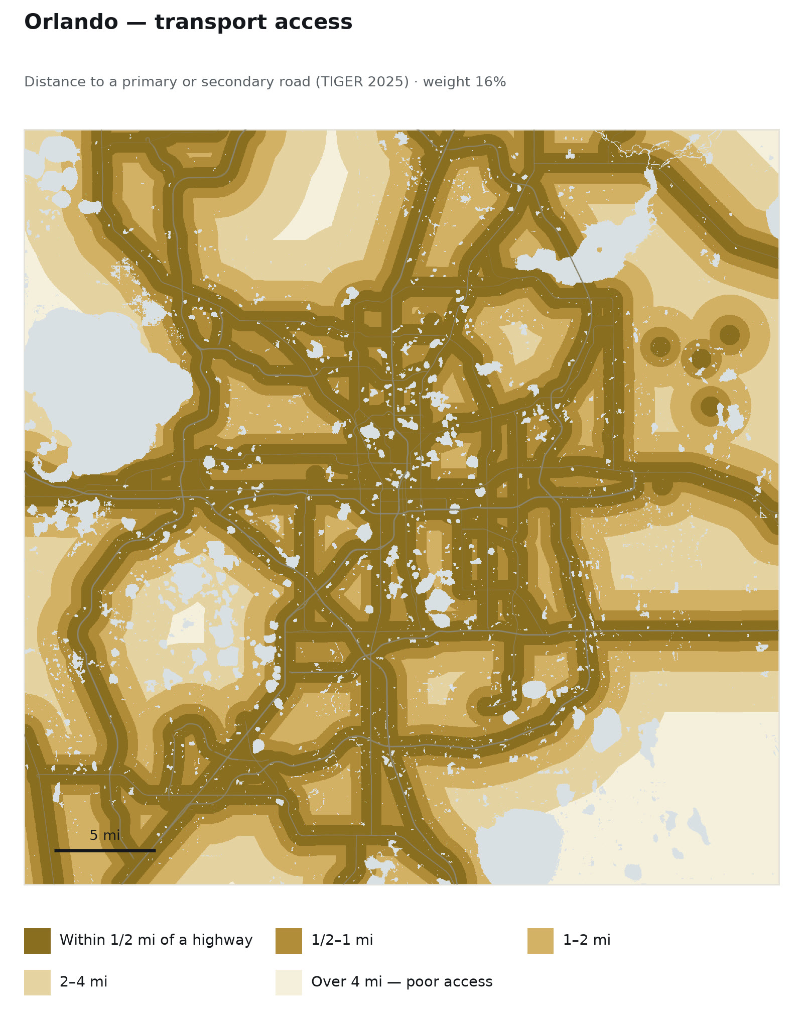
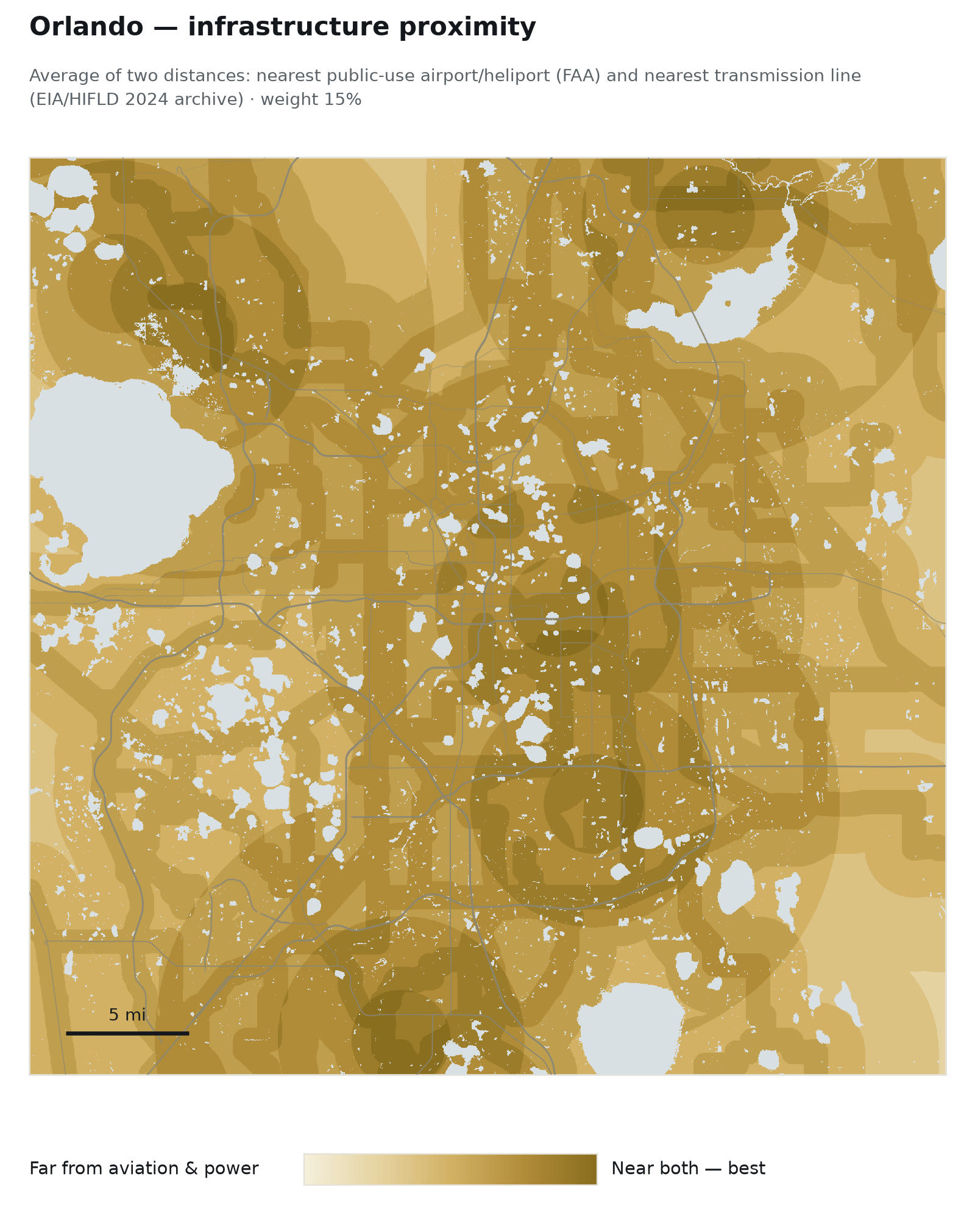
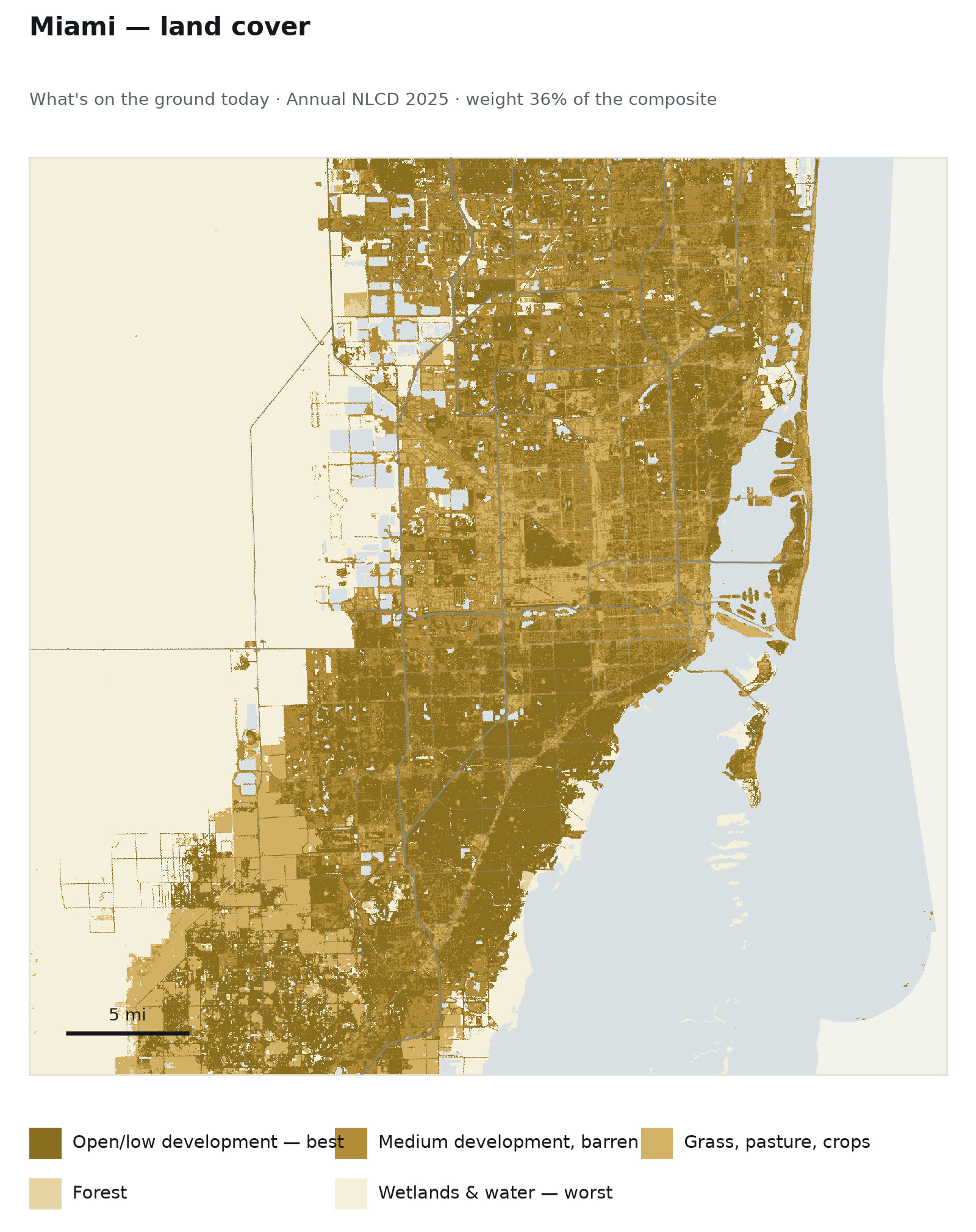
Each criterion scored on a common scale before weighting, and the hard exclusions applied separately after.
District-scale assessment
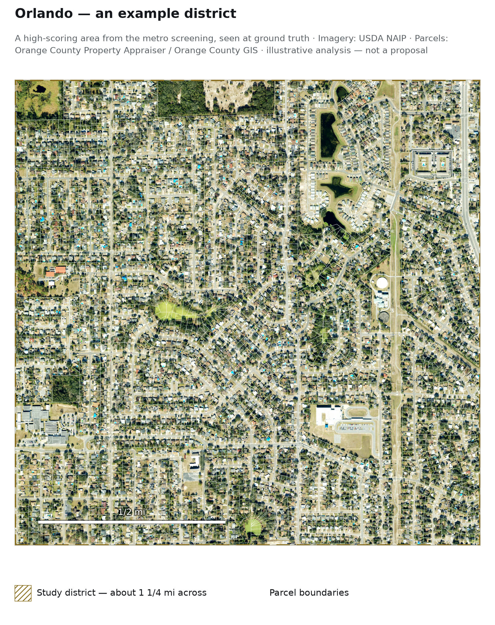
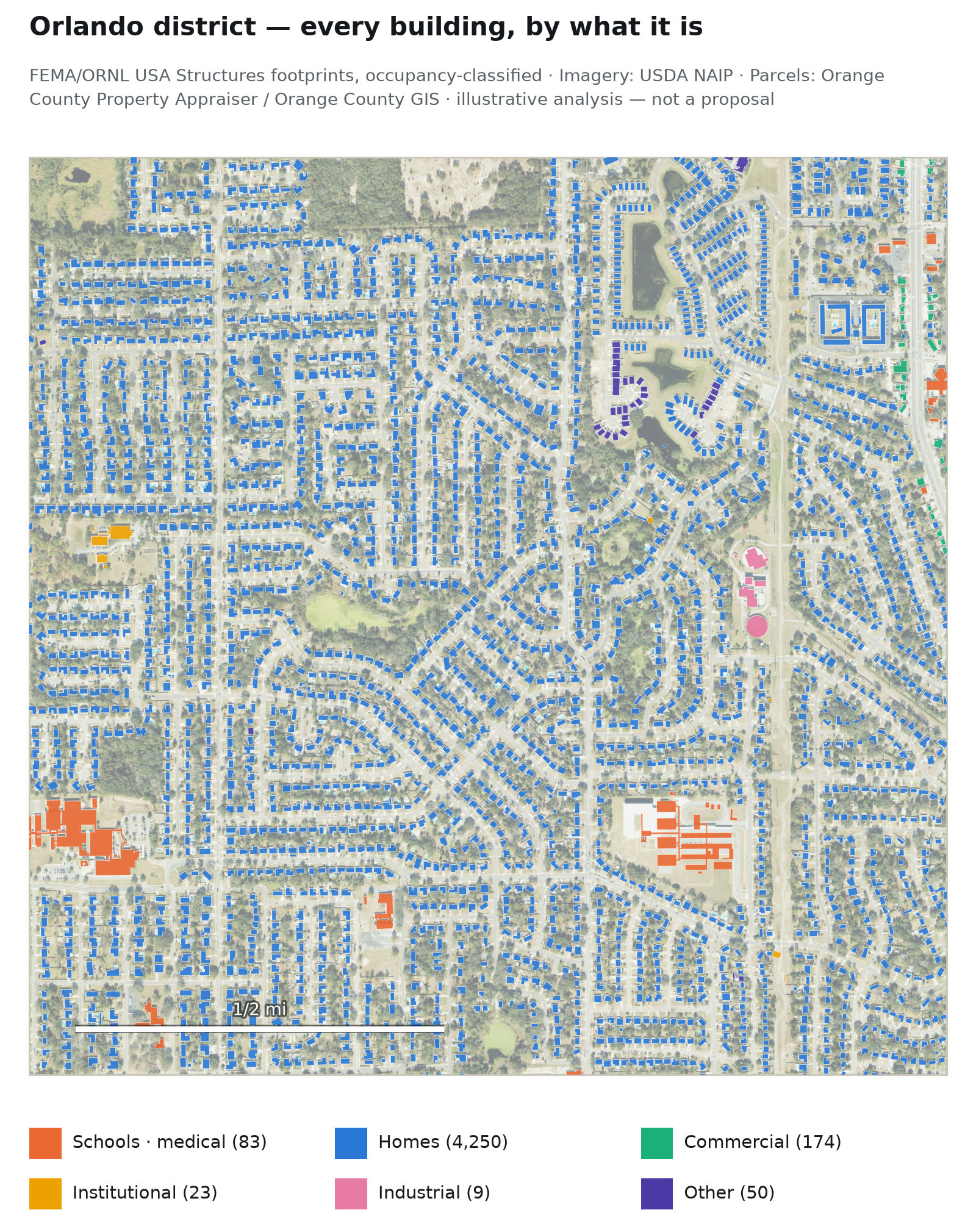
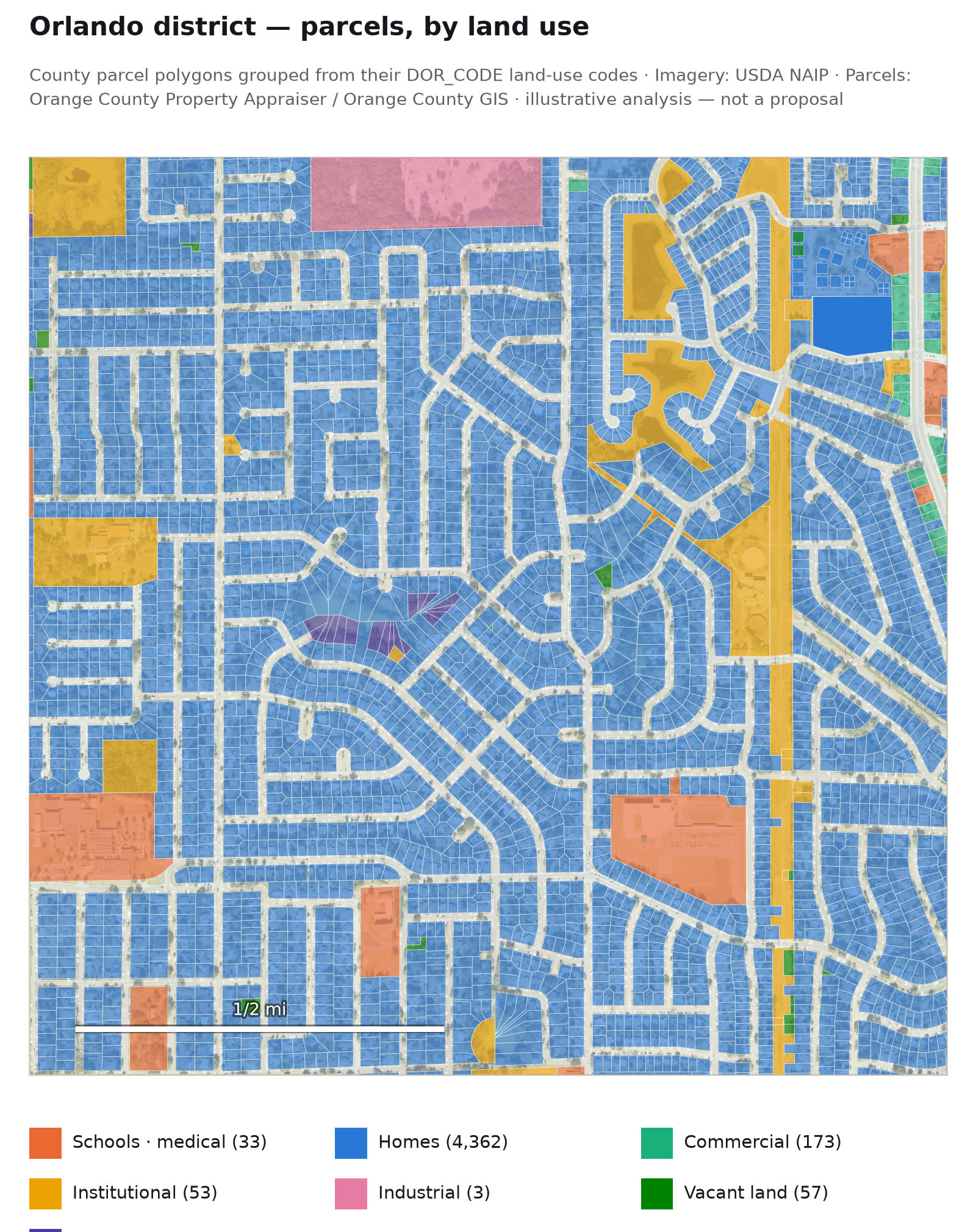
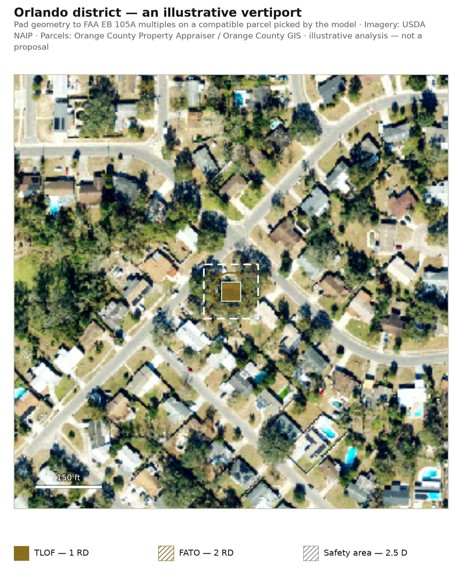
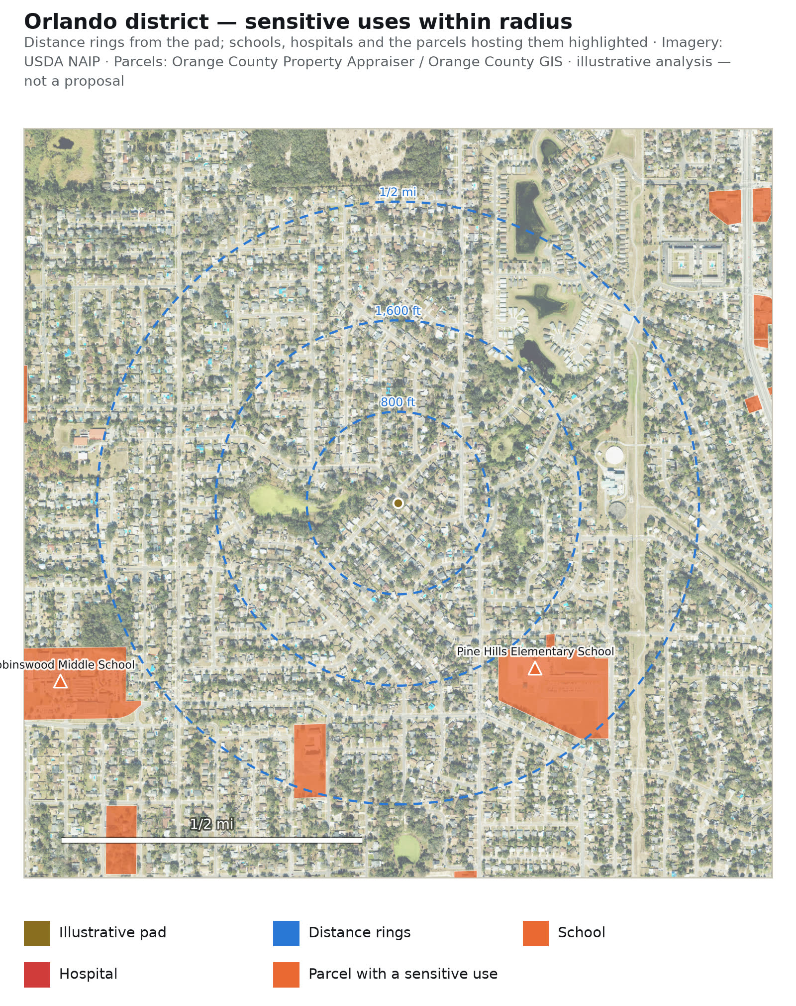
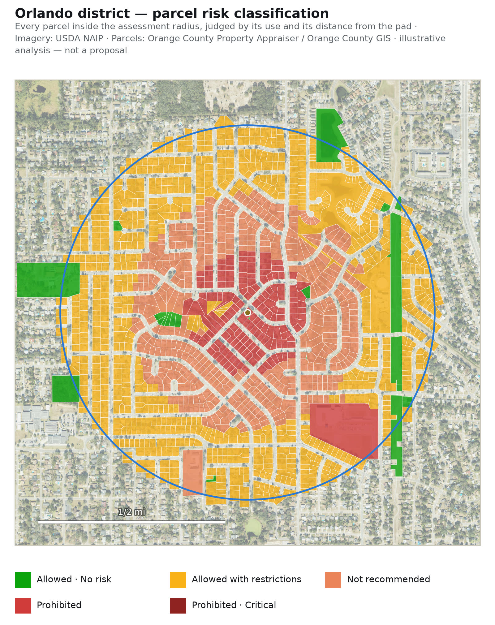
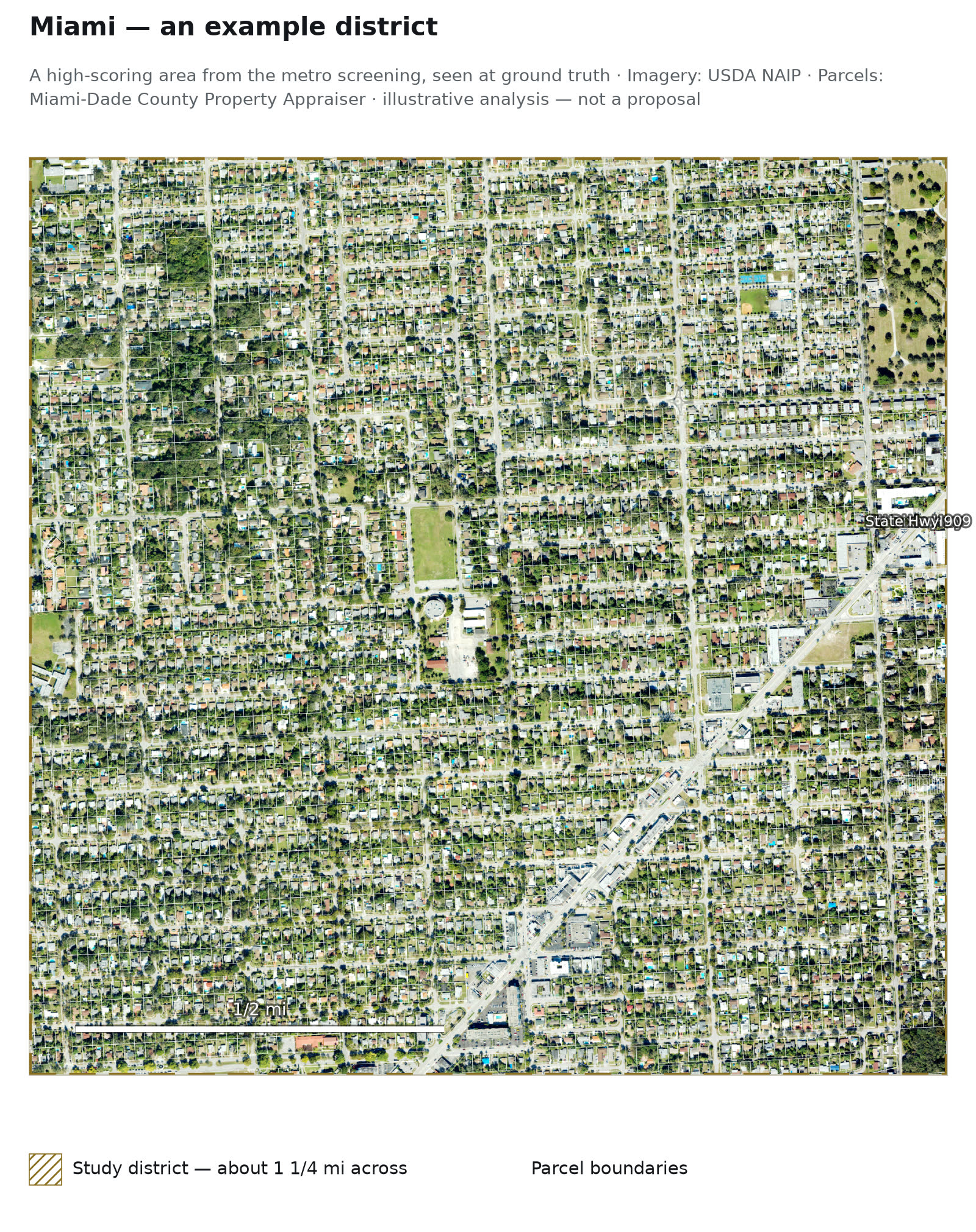
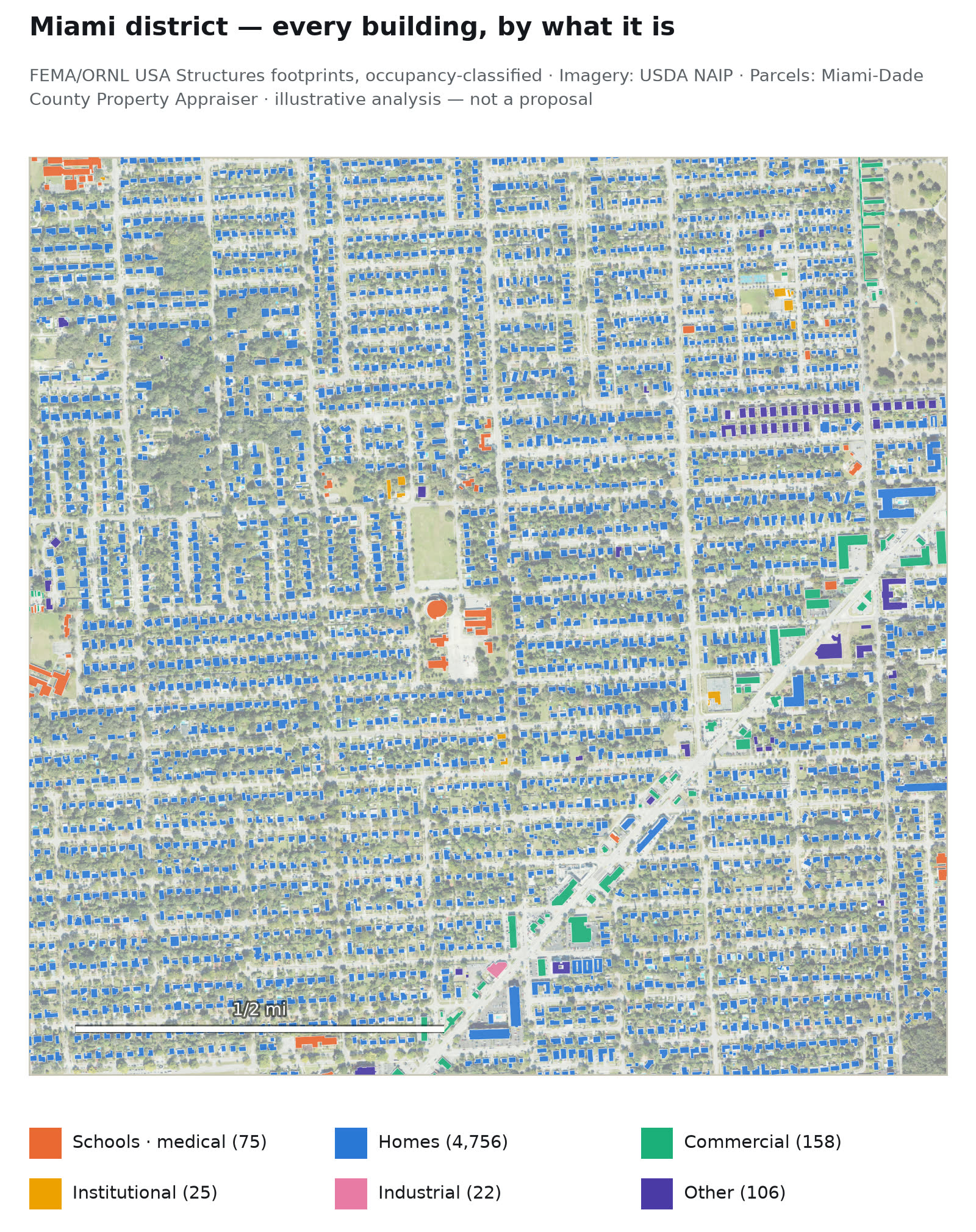
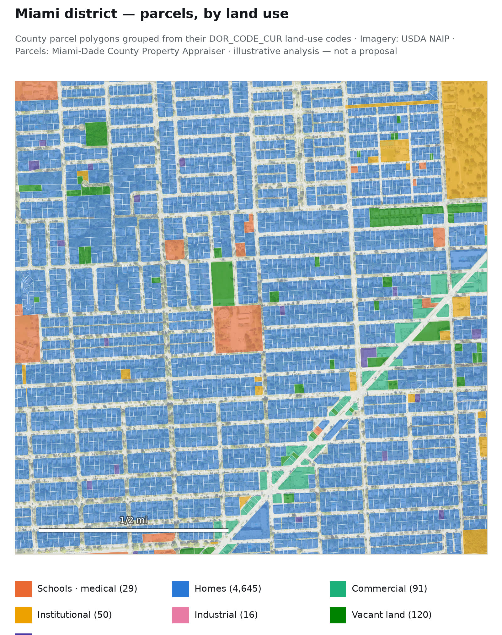
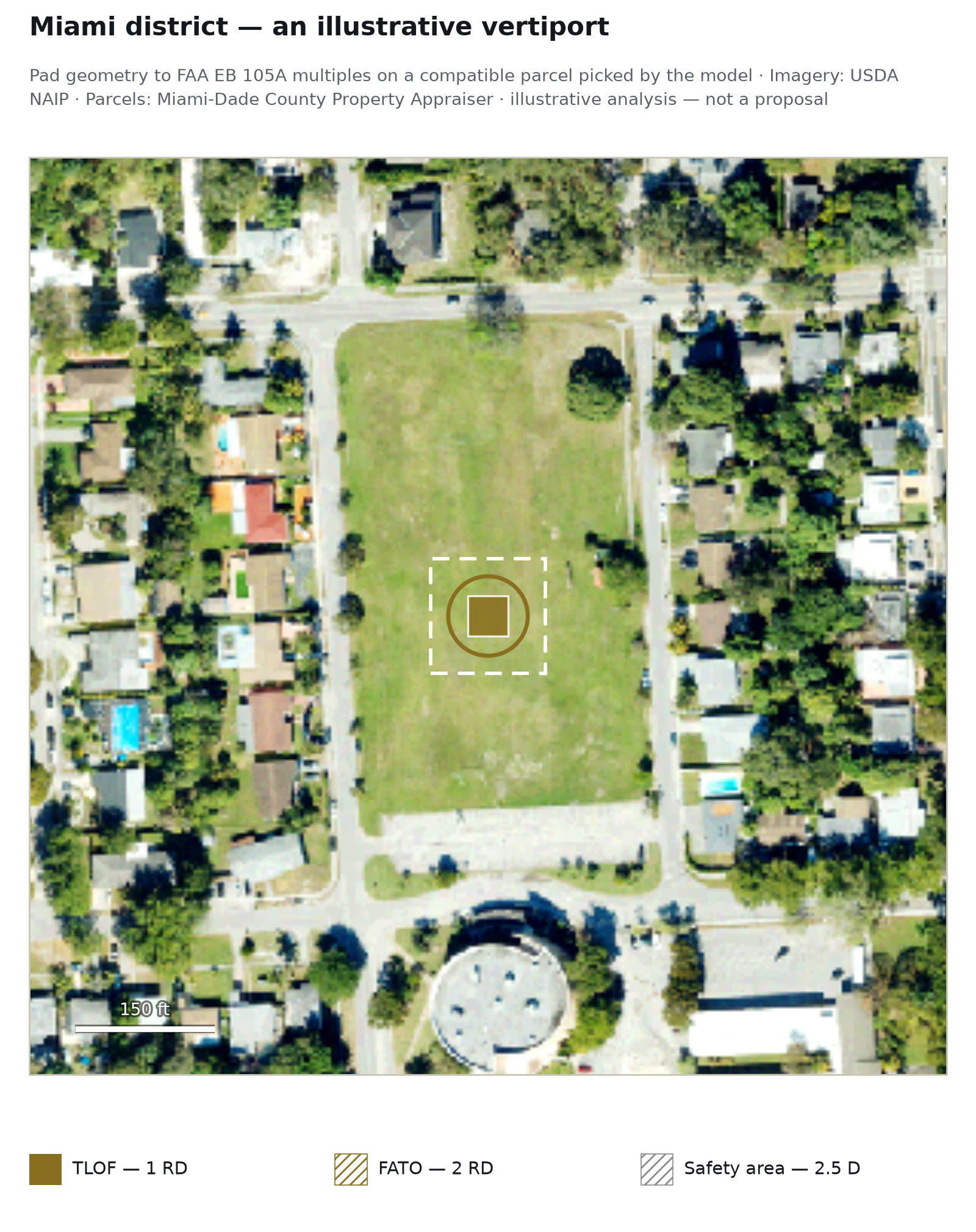
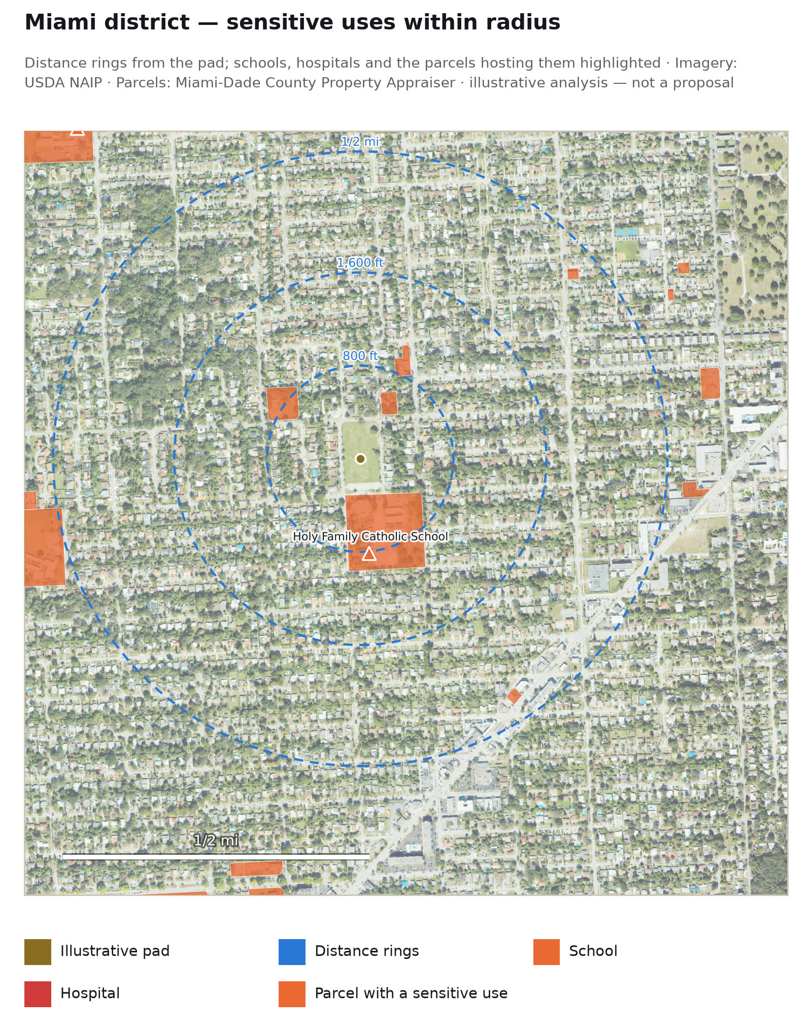
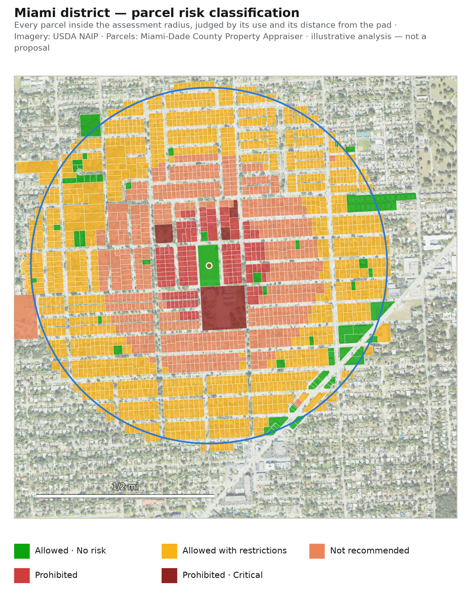
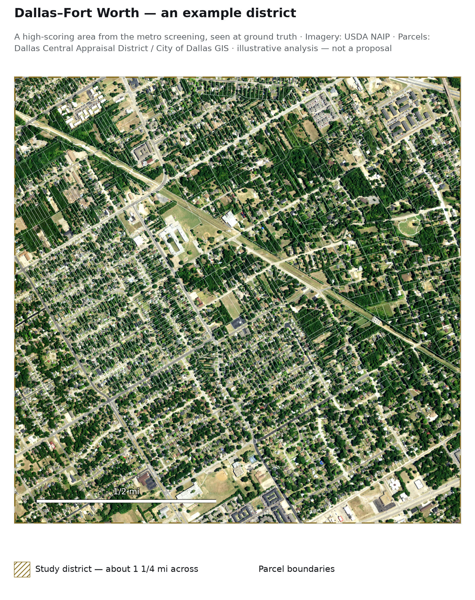
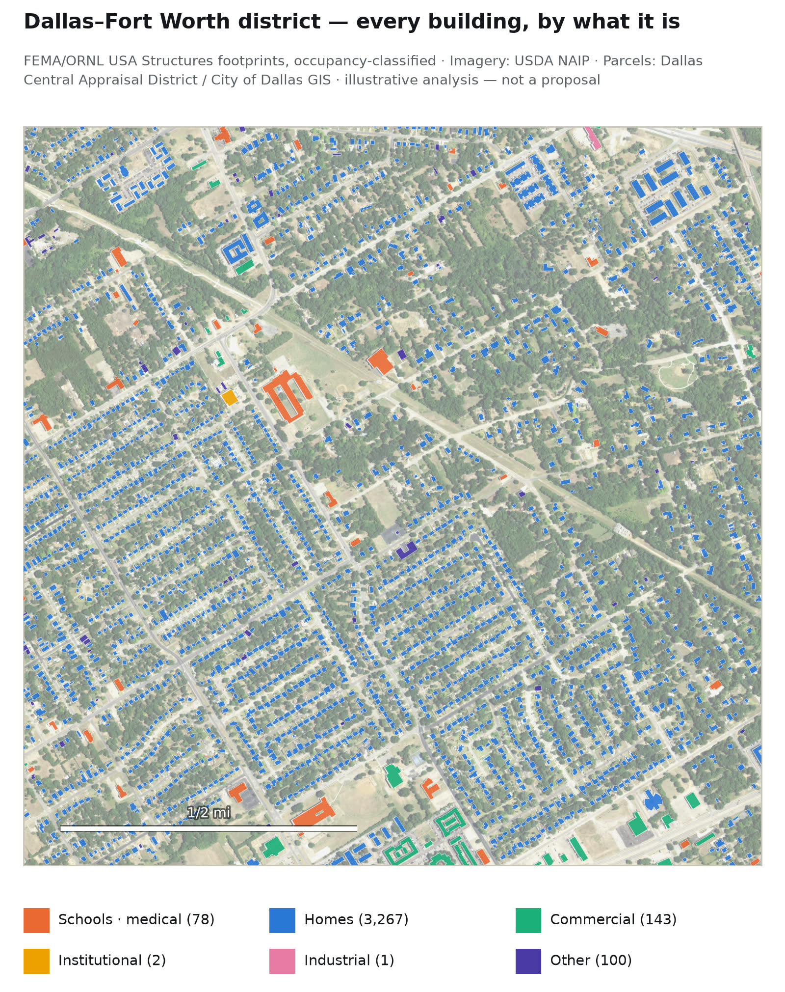
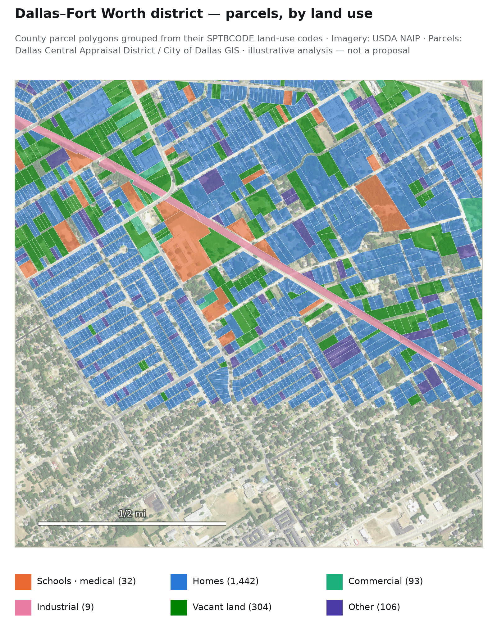
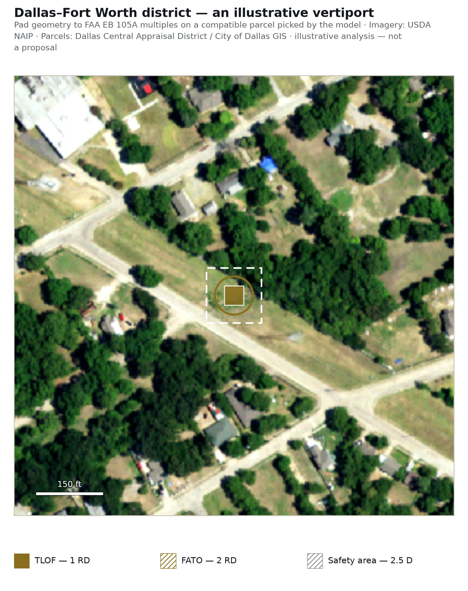
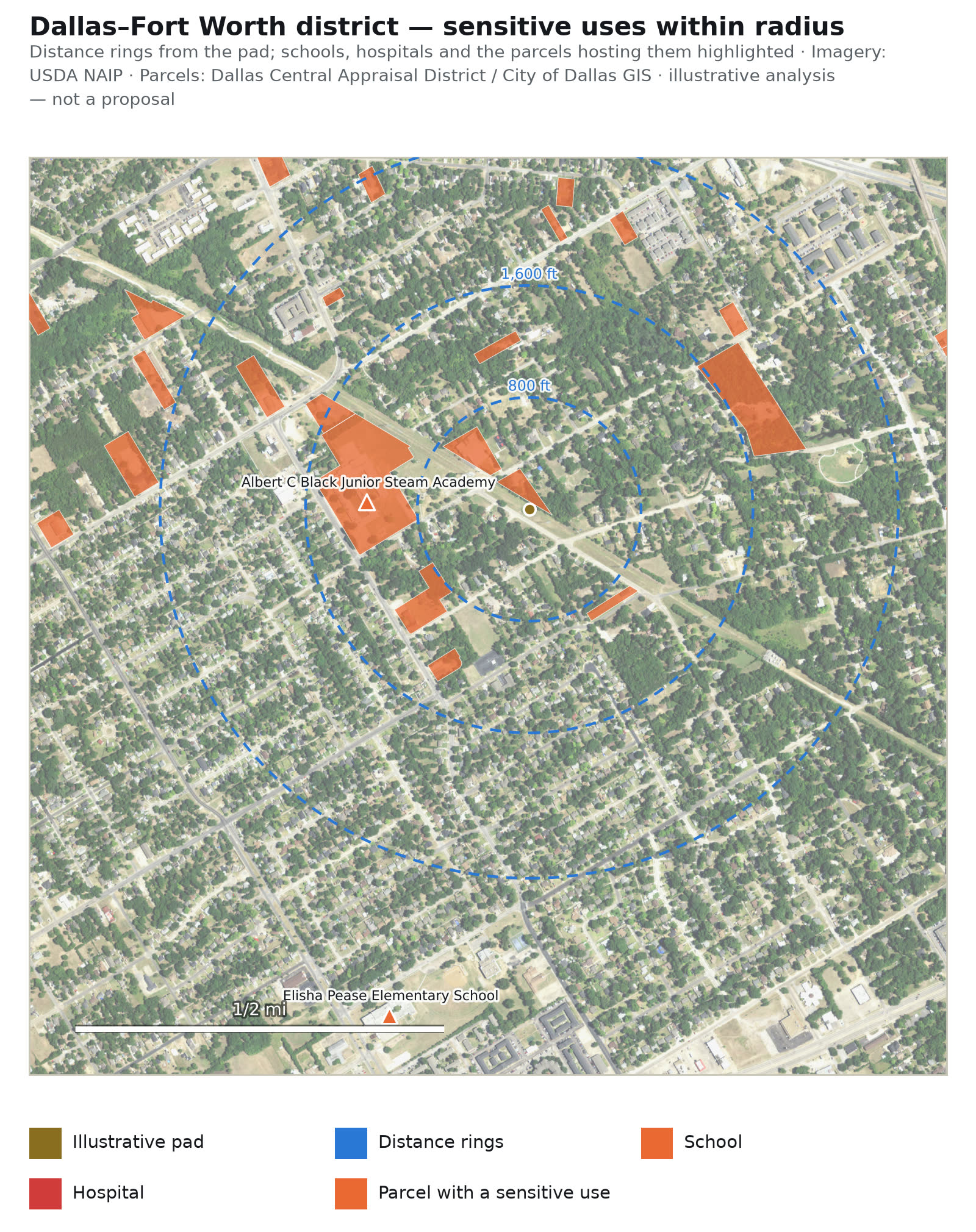
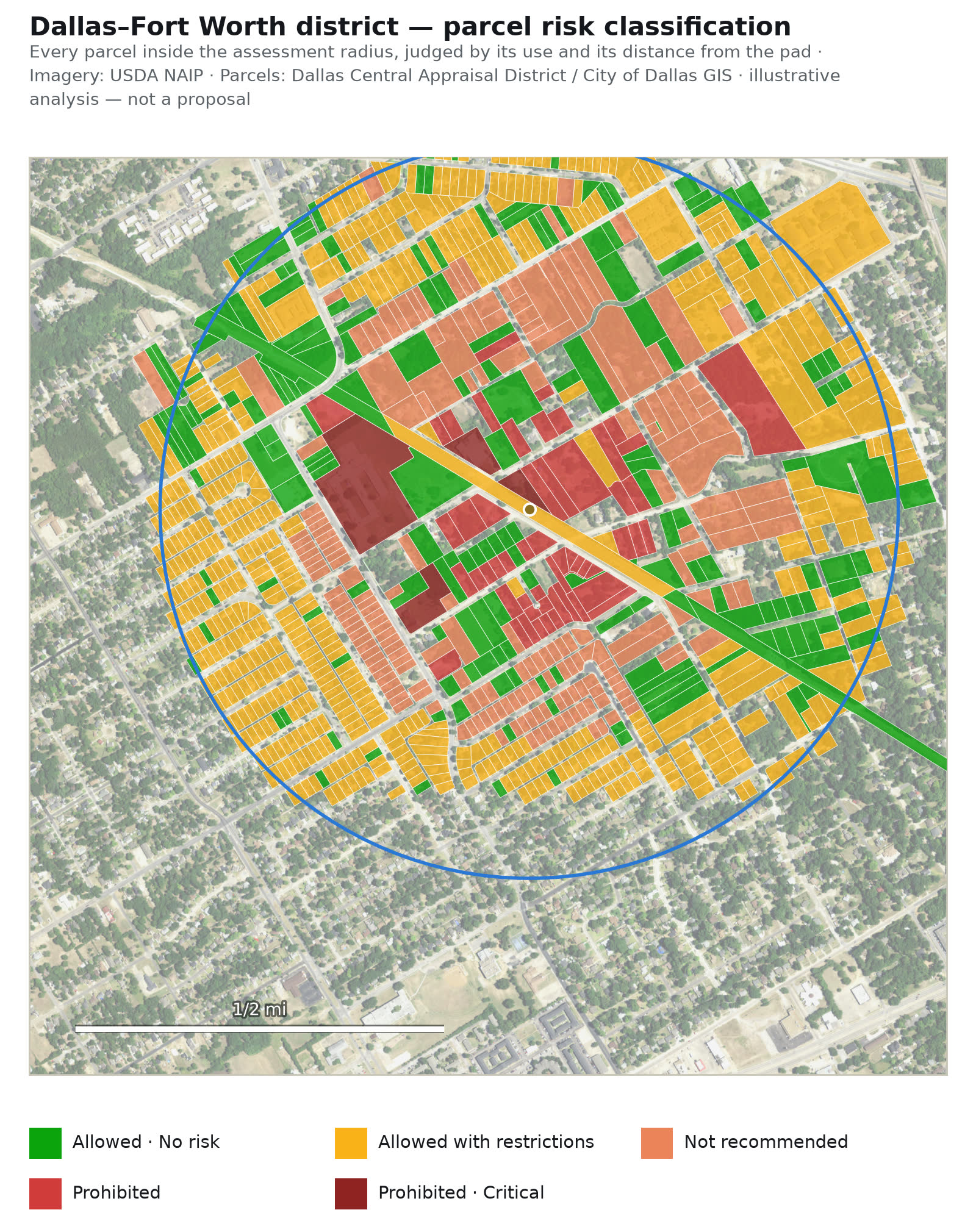
Inside one high-scoring district per metro: the ground truth, every building and parcel classified, an illustrative vertiport to FAA geometry, sensitive uses within radius, and a parcel-by-parcel risk classification.